Kestrel Court
Public Hearing Presentation
February 6, 2007
Salisbury Planning and
Zoning Commission

Pete and Mary
|
Kestrel Court Public Hearing Presentation February 6, 2007 Salisbury Planning and Zoning Commission |
Pete and Mary |
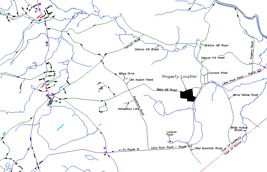
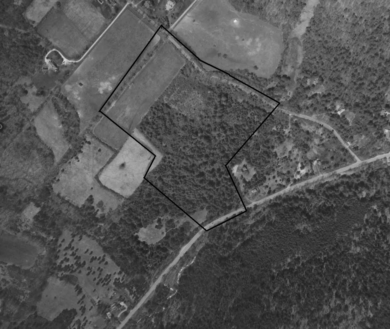
Project Location on Wells Hill Road and Lime Rock Road.
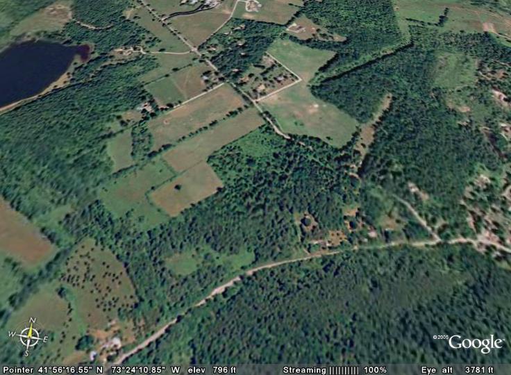
Overview from Google Earth showing nearby fields favored by the American Kestrel, and hence the road name.
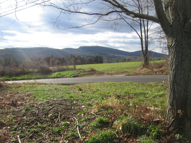
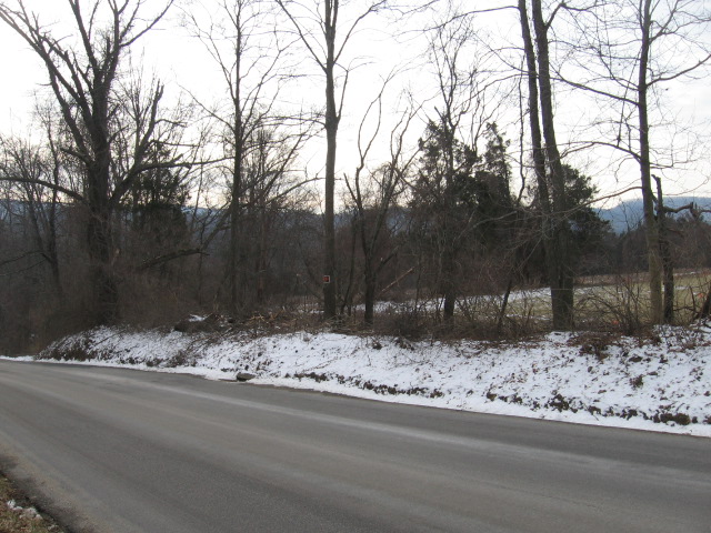
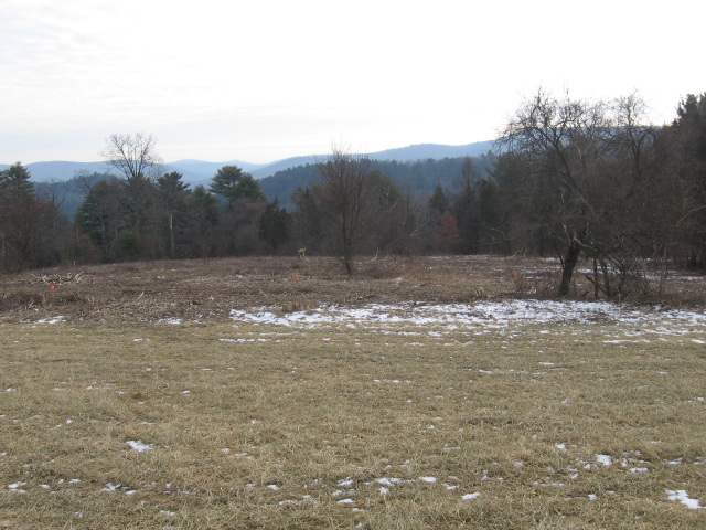
Scene from Wells Hill Road facing South.
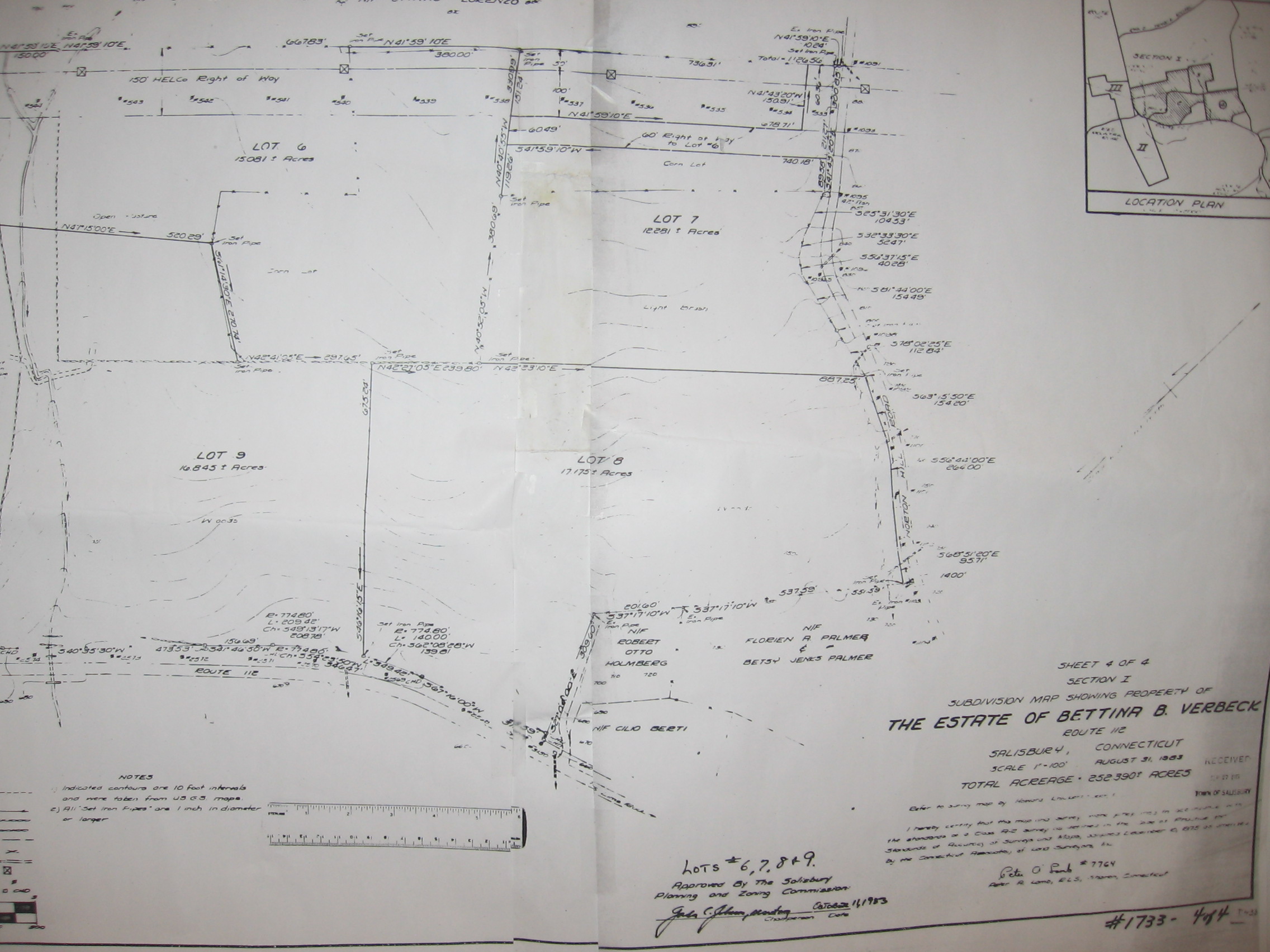
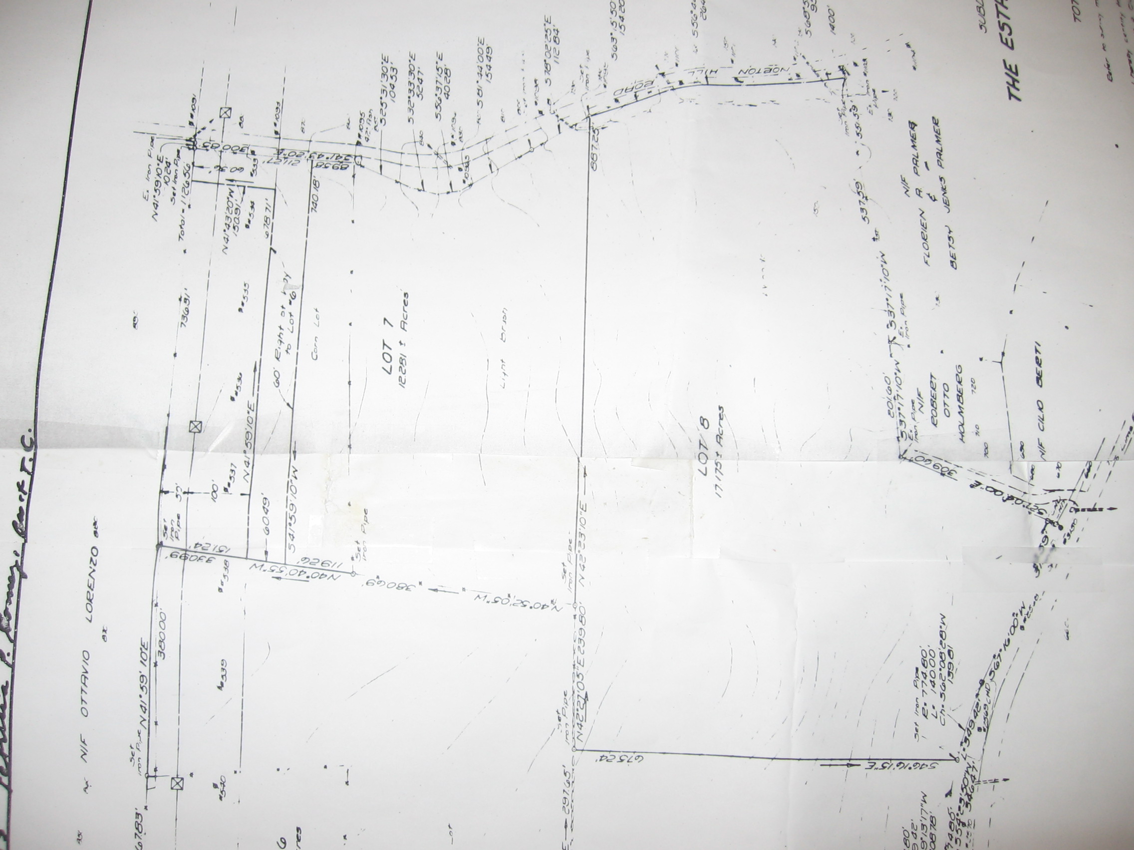
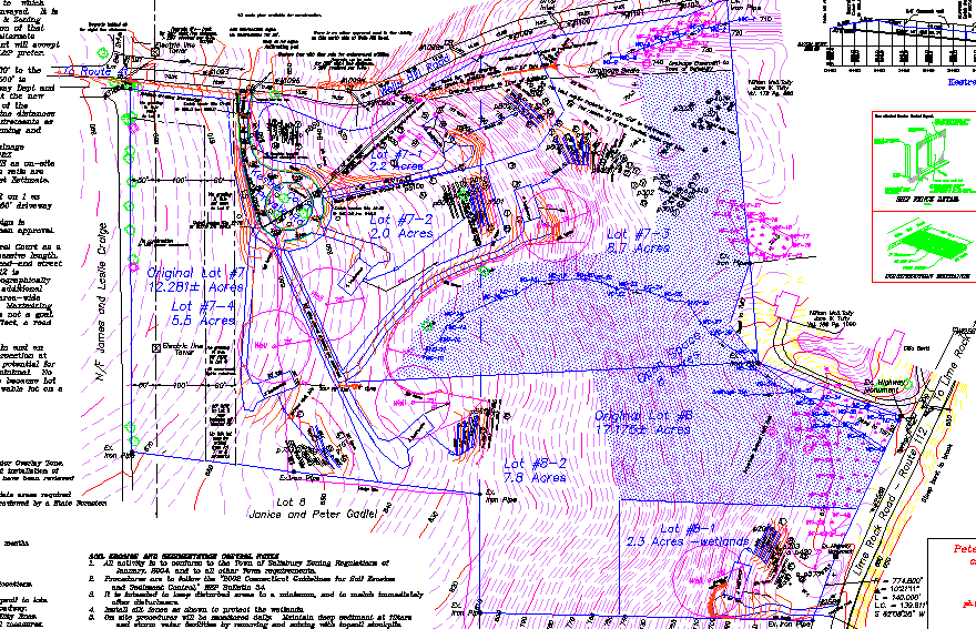
Existing Verbeck Subdivision Map #1733 in Town Clerk's Office. Prepared by Peter Lamb RLS in 1983.
Shows lot 7 at 12.281 acres with CL&P easement and Right of Way for Peter and Janice Gadiel.
Lot 8 with frontage on Wells Hill Road and Route 112 has 17.175 acres.
Aerial Photo used to generate 2' contours.
New maps now rotated 90 degrees to the left. with North Arrow to the upper left hand corner.
Wells Hill Road is on the top. Lime Rock Road or Route 112 on the right.
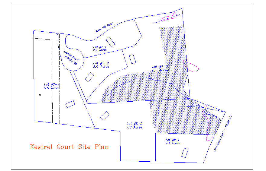
Proposed Lot Lines and House Sites.
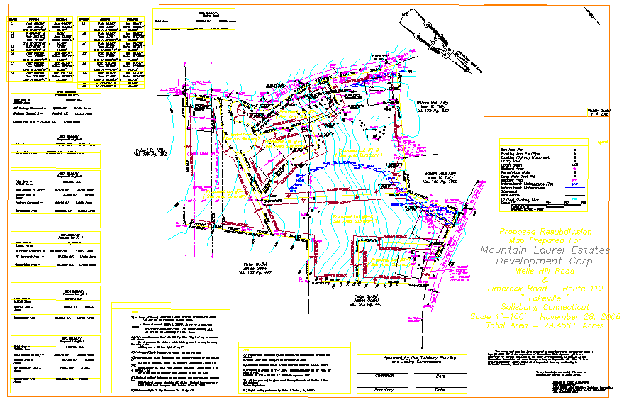
Subdivision A-2 Survey Map from preliminary review email.
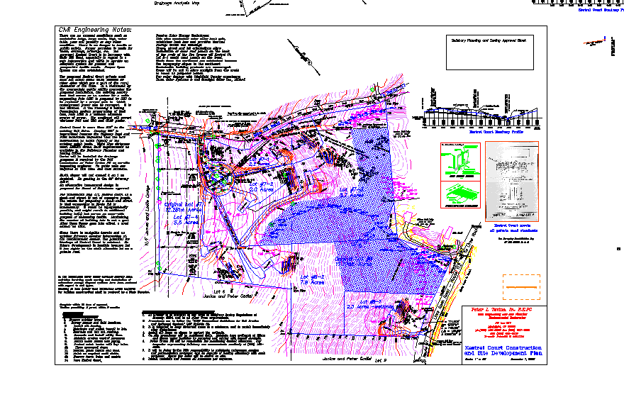
Overall Site Development Plan dated Dec 1, 2006
Same Site Plan showing six house locations. Blue dots show 8 acres Open Space = 27% of 29.5 acres total.
The Open Space includes level areas originally planned and tested for septic systems.
Mostly the CE provisions, familiar to the Town from our work here a few years ago, protect the wetlands.
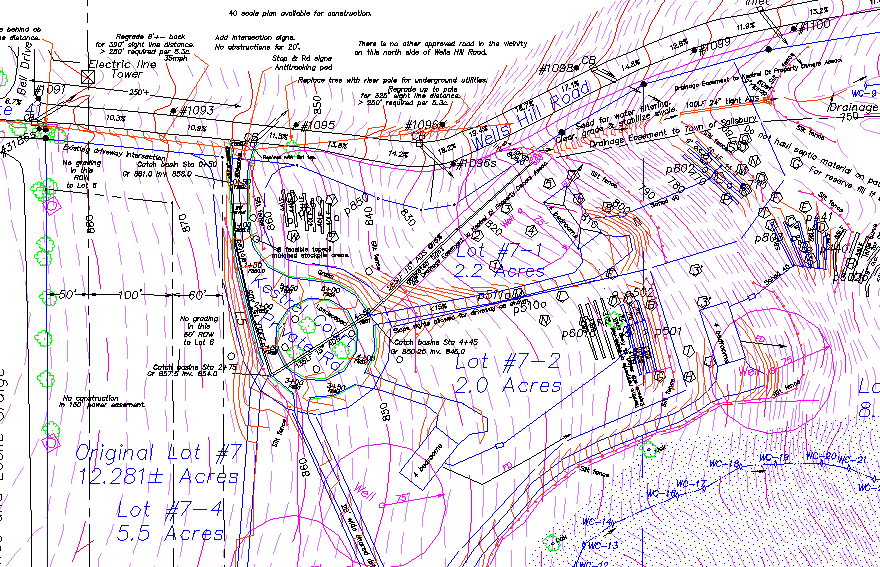
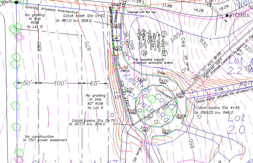
Kestrel Court with Stationing
Kestrel Court Grading does not extend into Peter and Janice Gadiel's Right of Way.
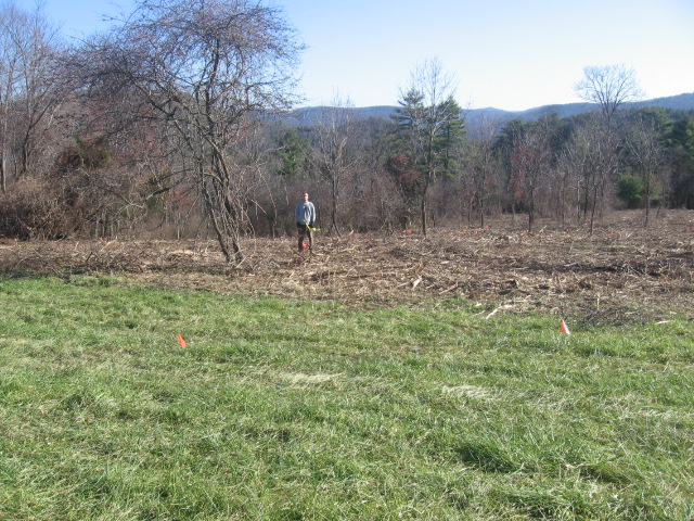
Our son Greg stands in the center of the proposed cul-de-sac circle. Photo from Catch basin Station 2+75.
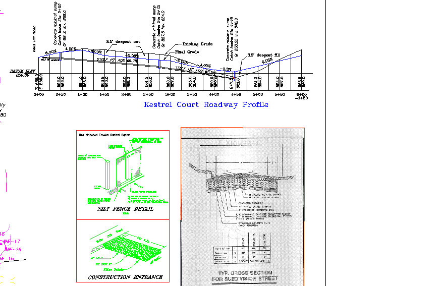
Road Profile and Cross Section. No grade steeper than 6%. Deepest cut 3.5'. Deepest Fill 3.5'.
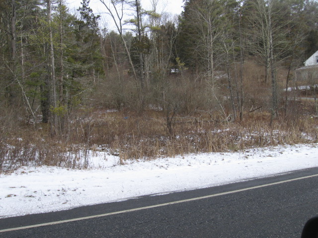
Proposed Kestrel Court intersection will be to the right of this catch basin on Wells Hill Road.
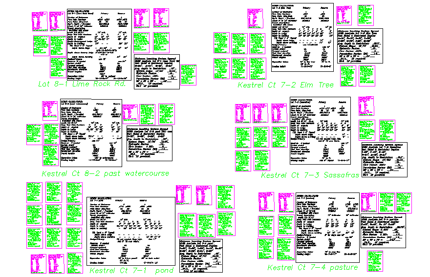
Soils Data submitted for TAHD approval. Each lot is named. Percs in purple. Deep Test Hole classifications in Green.
Proposed house for Lot 7-2 "Elm Tree" in yellow tape at center. Preserved elm tree is tallest in vicinity.
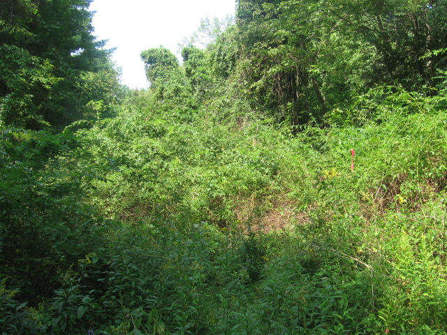
Wetlands Flag 3 or 4 with invasive honey suckle and bittersweet this summer. (In town drainage easement.)
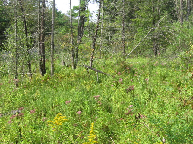
Wetland near Route 112, being preserved by being divided among separate property owners.
Same wetlands last week.
Most importantly, Kestrel Court meets all Town of Salisbury
Planning and Zoning and Subdivision regulations.
Thank you.
Just briefly, we would like to thank our expert sub consultants and contractors who helped prepare this design.
We thank the Torrington Area Health District's Tom Stansfield, CL&P's Rick Reynolds, DOT's Jack Boutin.
Our neighbors on both sides of Wells Hill Road,
the Salisbury Wetlands Commission, Board of Selectmen, and this Planning and Zoning Commission and Office
for their time in study of this resubdivision of our beautiful Lakeville property.
Sincerely,
Mary and Peter Tavino PE
Mountain Laurel Estates Development Corp.