British Columbia (Farewell Harbour) kayaking trip journal.
We have such a beautiful planet and Mother Nature never ceases to amaze me. About a year ago, I printed out the listing of UNESCO sites, and my goal is to explore as many as possible in my lifetime. Even though Farewell Harbour is not on the list, in my mind it is. It combines incredible natural beauty along with my love of animals and kayaking. What I find interesting about travel is that if you fly over these places at 30,000 ft and 500 mph, they don’t appear particularly special but if you take the time to explore, you are in for natural wonders.
My Farewell Harbour (FH) journey started out with a flight from Houston to Seattle. I flew into Seattle a day early to make sure I did not miss my float plane flight to the lodge the following day. I had several options to get to FH, but most of them included a combination of planes, boats and cars. From my travel experience, there is always a risk of missing a connection, especially when it combines different modes of transportation. In the end, I decided to take a float plane directly to the lodge from Seattle [float plane pic].

Due to it remote location, the FH lodge can only be reached by boat or float plane. The float plane trip was very enjoyable as we traveled around 1500 ft and were able to see animals, boats, trees, islands, waterways and many forms of natural beauty along the way. There were several stops during the flight. The first stop was Canadian Customs in Nanaimo. We then dropped off other passengers at Blind Channel Lodge and Echo Bay. Most of the lodges in the area focused on fishing.
FH is located approximately 200 miles north of Vancouver and is located on the waterway named the Inside Passage. This passageway runs between Vancouver Island and mainland British Columbia. Cruise ships departing Seattle or Vancouver traveling to Alaska use this waterway because it is beautiful and it is much calmer than the waters of the Pacific Ocean.
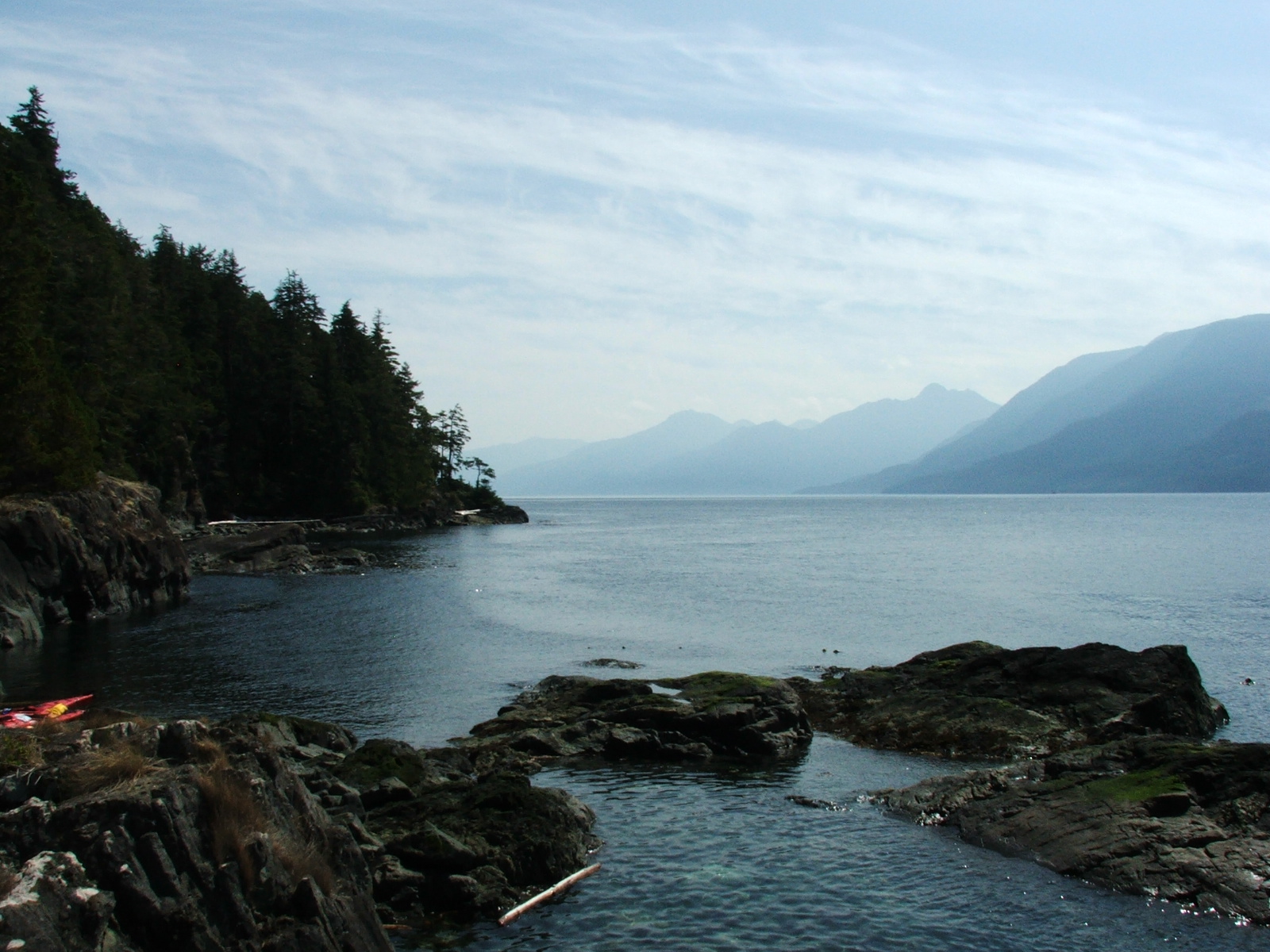
When I arrived at the lodge, I was met by the lodge staff at the airplane. The lodge capacity is 12 guests, but due to the economy, I was the only one there for the first day. This allowed me to be pampered by the entire staff (2 guides and 1 cook). I arrived at noon and a hot meal was already waiting for me. Now that is Canadian hospitality, eh. The lodge is located on Berry Island
The lodge is located on a nice cove and we often had 3 or more fishing boats anchored nearby each night. Berry Island has 5 nice access points to Blackfish Sound and Johnstone Strait (both popular fishing and boating channels) and this makes it a convenient spot to put down the anchor.
The 2 guides and 1 photographer (at the lodge to do promotional shots) were anxious to go kayaking when I arrived. I didn’t disappoint them. Apparently the previous guests decided to fish instead of kayak so they were excited to finally be able to get out paddling. The first afternoon was sunny and 80 F. This time of year (August) the day is usually foggy until 1 p.m. and then there is sunshine throughout the afternoon. This area is has one of the largest concentrations of Orcas in the world and is the main reason I decided to kayak here. In fact Blackfish, in the local First Nation language, translates to killer whale. We came across several porpoises and seals on our 8 mile afternoon paddle.
On the second day, the four of us decided to paddle around Swanson Island. The senior guide was listening in on the navigation radio for Orca (killer) whale sightings. It is well known that most animals in the water can swim much faster than a person can paddle. In addition, the fish or mammals can move 30+ miles a day. Therefore, communication and luck are critical in trying to get close to many of these animals. The guide didn’t get any sighting reports, but we decided to take this route as Humpback whales commonly feed around this island.
We paddled for several hours around Swanson Island and then pulled into a nice cove for a break (stretch, eat, etc.) [cove pic].

This was a perfect area for bald eagle nesting and we did see one perched up in a tree. After our break, we continued our journey around the island. The photographer heard a couple of whales breathing off in the foggy distance. They were feeding out in the middle of a channel and our senior guide was hesitant to head out into the fog as a boat traveling at any speed would have a hard time seeing us. Other dangers are losing sight of land (paddling in circles with no sense of direction), tide current and large waves from the wind or boats. We decided to stay closer to shore and wait to see if they would come closer to us. The guide mentioned that Humpback whales do not usually partner up this time of year and that the two were likely a mother and her calf. It is amazing how much territory these mammals can cover. We would hear them several miles in one direction and then minutes later they would be several miles from that location.
After waiting for some time, we decided to continue on our original route and head back to the lodge for lunch. Out of nowhere, the mother surfaces about 1/8 mile in front of us. The photographer got very excited and quickly got his camera and telephoto lens out of his dry bag. The whale appeared to dive but we soon found out this wasn’t its course. In a matter of seconds the whale closed the 1/8 mile gap and ‘buzzed’ our kayaks. The female adult whale was about 40 ft long and 20 tons. In the picture [whale pic]

you can see part of the tail and some splash coming off it. It helps to enlarge the picture. Apparently the whale could not detect us because we were not paddling and also she was focusing on her calf. When the whale did detect us, she did a quick dive. The professional photographer in our group is in the red kayak and is in perfect position for the ‘shot’. Unfortunately the whale came upon us so quickly that he didn’t have time to take off his telephoto lens and get a clear picture. The gentleman in the blue kayak is the senior guide. I can only image what is going through his mind as this whale is heading directly for him. He didn’t know if the whale was coming up or going down! A female guide took the picture and I am off to the left of the picture. It was an incredible experience.
After lunch that afternoon, the senior guide and I paddled around Crease Island. Along the north side of the island there was exposure to the wind and this generated moderate wave action. For safety reasons, we eddy hopped along the north edge of the island. Most islands are not perfectly round; they have coves and inlets. Usually the rougher water is out along the protrusions. When a person eddy hops, they save up energy to quickly and powerfully go around the protrusions and head into the calmer waters in the cove or inlet. This helps reduce the risk of running out of energy in the larger wave action areas.
Further around the island we traveled through an area called Swanson passage. The unique feature of this area is that the tidal current met in the middle of the passage (i.e. tide came in from both directions). We paddled with the current for ½ the distance, then through waves where the tide currents met and then paddled against the current the 2nd half before returning to Farewell Harbour. It is very easy to know if you are paddling with or against the tide. A hint, one of them is like dragging and anchor! One way to quickly spot current direction is to look at the direction the Bull kelp ribbons [bull kelp pic].

Bull kelp anchors to the seabed, can grow an amazing 10 inches a day and can reach 60+ feet. The ball on the surface is called the float and it has up to 64 ribbons extending from it. These ribbons float on the surface and are a good indicator of current direction.
On Tuesday, one of the 6 co-owners flew into the lodge with his Cessna 185. He brought his 2 sons. One of which was recently married (the previous weekend). His new daughter-in-law came along as well as this was their honeymoon. It must be a Canadian thing to go on your honeymoon with your brother-in-law and father-in-law, eh.
One of the reasons the owner flew in at this time was to assist the photographer in getting promotional shots of the lodge and activities at the lodge. On Tuesday evening, we went up in the Cessna to take photographs of the lodge. We flew out over Johnstown Strait and saw a pod of Orcas and several cruise liners returning from Alaska. Later on, we had a wonderful dinner and the owner was very generous with the New Zealand and Australian wines he had on hand. After dinner, we soaked away the kayaking pains in the lodge hot tub.
The guide talked me into going out fishing one day. After breakfast on Wednesday, the senior guide and I went salmon fishing. There happen to be several fish farms in the area. The locals are concerned that if fish escape, they will interbreed with the native fish and change the ecosystem. Most Canadians exercise a catch and release philosophy as it is very easy to catch fish.
Due to the warm weather and thus warm water, many salmon died on the journey to spawning areas this year. Enough salmon made it to areas where the bears feed but not to the spawning beds. Therefore, the bears were able to feed this year, but in 4 years the spawning numbers will be much lower and thus there will be far fewer salmon for the bears to feed on.
Salmon are a very unique fish. They are born in fresh water and then convert to a salt water metabolism. This is known as osmoregulation and they are called a euryhaline species. The spawning cycle is a race against death as the salmon can’t convert back to a freshwater metabolism. Therefore, their greatest danger during spawning is time and not the bears. All salmon that spawn die due to the inability to properly regulate oxygen in their body.
We left the lodge around 7 a.m. to go fishing and this happened to be around the end of the morning tide. Even though we were almost to slack, the current rip currents in Blackfish Sound were still strong enough to push our small motorized boat sideways. We trolled along Parson Island and I was able to catch 6 pink salmon. After several hours the fishing slowed down and we decided to try another location. As we were traveling over to Cracroft Point, the guide mentioned that the fishing was now ruined. I asked him what he meant and he pointed into the water. I noticed 5 dolphins alongside our boat. They were hunting salmon along the rip current. I then noticed 20 dolphins, then 30, then 50 [dolphin pic].

I counted 60 dolphins feeding in the area. The guide was surprised to see so many feeding in one area. The guide picked the right spot to go fishing; the only problem was that we arrived too late.
Thursday was my final day of kayaking and it was also the most interested trip that we took. We left around 7:30 am for Hanson Island. Orca whales frequently hang out around this island. The fog was very thick and my guide had a difficult time keeping us on a straight trajectory for the 2 mile crossing. Even though it was slack, there was a current and many whirlpools. Once we crossed over from Whitebeach Passage to Burnt Pt, we headed south to a whale research station on the island. While pulling into the station, we heard a sea lion feeding off in the distance.
My guide and I traveled inland to see a 1000 year cedar tree. The tree is named grandmother cedar [cedar1, cedar2 pic].


Most logging of the old growth trees was done in the late 1800s and early 1900s. This tree was likely spared due to the fact that it has a twisted trunk.
There were many ‘starter’ trees in the forest. These are trees that have fallen over, died and generate a new tree by the decomposition of their cellulose. The most prevalent species of trees are the Cedar, Hemlock and Douglas Fir.
We then hopped back into the kayaks and headed northwest as we wanted to go counterclockwise around the island. This path would allow us to go with the current most of the day. On the northwest corner of the island is a channel called the Blow Hole. This is a narrow channel and apparently large volumes of water are forced to travel through this area during tide change. We timed our trip through the Blow Hole at slack and the crossing went well. The channel has several turns and the strong current, even at slack, pushed our kayaks side to side. My guide told me stories of boats being tipped over in the Blow Hole the evening before we were to travel through this area. He knew I was concerned about going through this area so he decided not to tell me until we passed through it.
Once through the Blow Hole, we traveled onto the Plumper then Weynton Islands. At the Weynton Islands, we came across three porpoises feeding. We tried to get close for a picture, but they are so fast. Several times they came close to the kayaks, but they were gone before we could get a picture. We then entered the Johnstone Strait and traveled east along the south edge of Hanson Island. I found a nice rock outcropping about ½ way down this side of the island and we stopped for lunch [lunch pic].
This area is a perfect spot for sea lions to catch some sun and have protection from Orcas. I dipped my legs into the 50 deg F water while we ate and they became num quickly.
After lunch we traveled to the east end of the island. We were still several hours off slack so we went ashore south of Licka Pt and did some exploring in the forest. The rip tide around Licka Pt if very dangerous and can reach up to 6 knots. When we looked out into Blackfish Sound, the water was moving so fast that it rose up 6-12 inches along the rip current line [rip current pic].

After several hours, we decided it was safe to continue up the island to our channel crossing point. We eddy hopped from Licka Pt to Burnt Pt. We crossed the Blackfish Sound channel at Burnt Pt and headed back to Farewell Harbour lodge.
Thanks Gerry for this very informative account !
Pete
Back to 9/27/09